Ultra Mirage El Djerid
Tozeur
The Ultra Mirage El Djerid is an ultra-trail held every year around Tozeur over four distances: 25, 50 and 100 km and, since 2026, 100 miles (162 km). The 10th edition took place from 1 to 4 October 2026 with 501 runners from 20 countries; a 2027 edition has been announced, with no date as of 3 November 2026.
Dates
Last edition: 1 October 2026 – 4 October 2026. The dates of the next edition have not been announced yet.
Source: La Presse, 02/09/2026 — accessed 20 October 2026
The Ultra Mirage El Djerid, or UMED, bills itself as the first ultra-trail in the Tunisian Sahara. It is run once a year in the Jerid region, around Tozeur. The 10th edition took place from 1 to 4 October 2026, with the races on Friday 2 and Saturday 3 October. The organisers have announced a 2027 edition, with no date published as of 3 November 2026.
Four distances, one stage
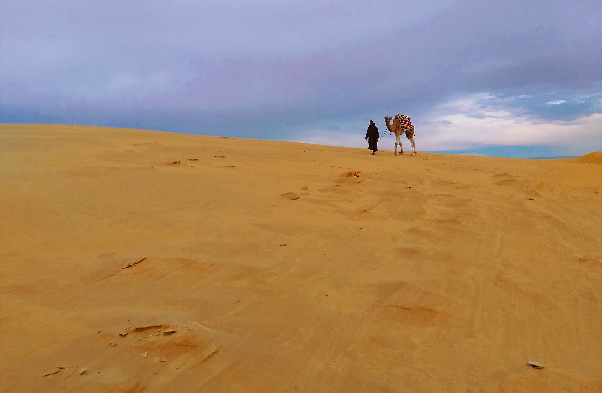
Each race is run in a single stage over very varied terrain: soft sand, small dunes, rocks, dry riverbeds and oases. Checkpoints provide medical and technical help and water.
| Distance | Runners in 2026 |
|---|---|
| 100 miles (162 km) | 32 |
| 100 km | 112 |
| 50 km | 212 |
| 25 km | 145 |
The 100 miles, created for the tenth anniversary, started on Friday 2 October at 6.30 pm local time, with a 32-hour cut-off: some runners spent the night on the trails.
Ten years of growth
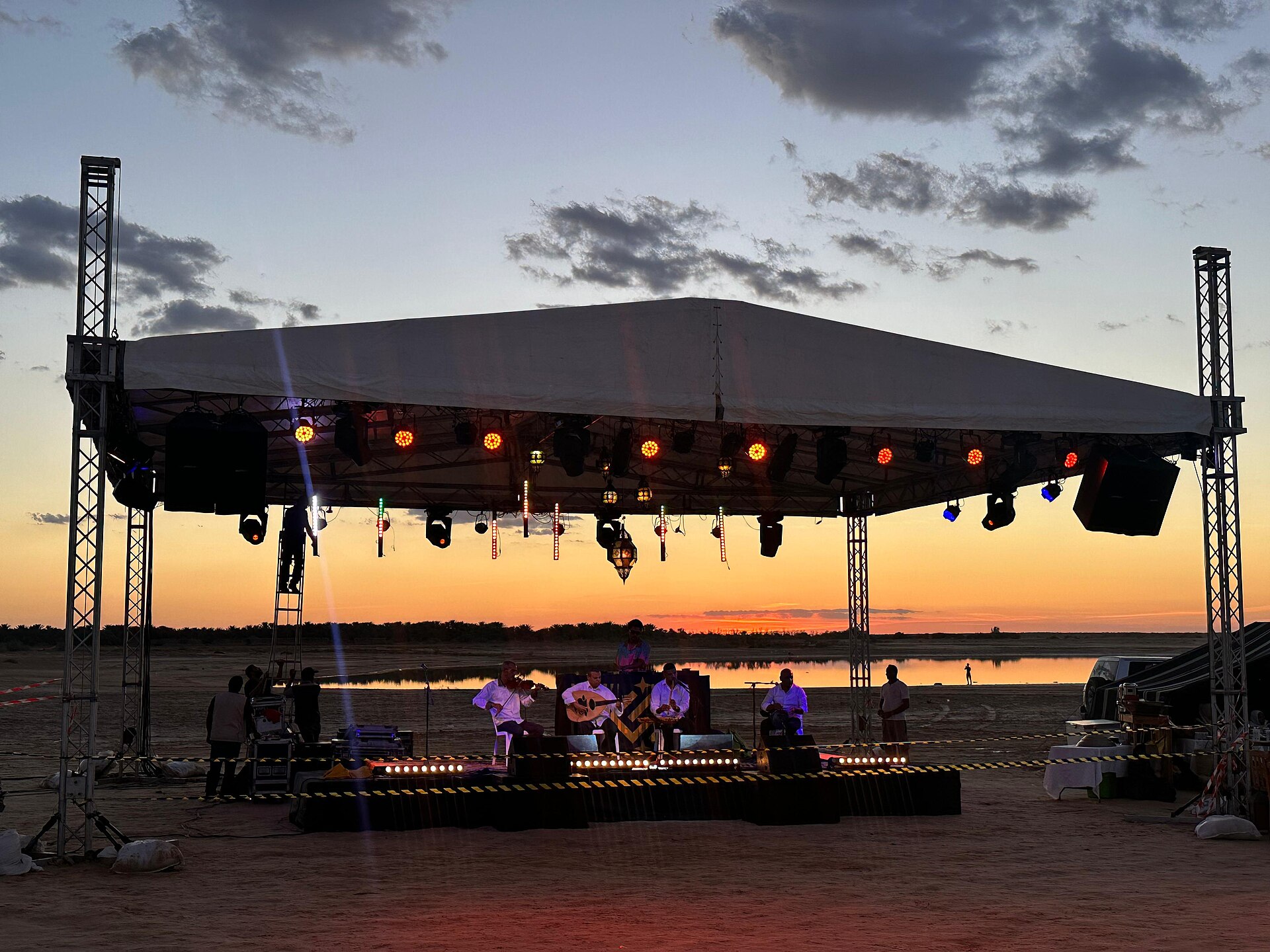
The first edition drew 60 runners from 12 countries; the 2026 race had 501 from 20 countries, and nearly 700 people were expected in Tozeur including supporters and crews. The race village is set up at Lake Shamsa, with craftspeople, local producers and food stalls.
The race is organised by the Association Ultra Marathon Tunisie, a non-profit. It was the first sporting event in the country to pay equal prize money to women and men, and one of the first signatories of the Courmayeur convention for clean sporting events; it relies on Jerid craftspeople and producers, dates included, and on local helpers.
Running in Tozeur in early October
Tozeur is still hot in early October: the average October high is 29.6 °C, and September's is 34.9 °C. Tozeur–Nefta airport is 2h55 from Paris by direct flighta few hours' flight from Europe's main cities, direct or with one stop, and Tunisair Express links it to Tunis.
The Jerid offers plenty to extend the trip: Tozeur's brick medina, Nefta and its Corbeille, Chott el Djerid and the Star Wars sets, described on the Tozeur, Nefta and the Jerid page. The two addresses chosen by Sabaro are The Mora Sahara Tozeur and Dar HI Life in Nefta. Later in October, the Défis du Chott offered shorter races of 10 to 40 km.
Foreign ministries do not all give the same advice. Your country's advice:
| Country | Official advice | Source |
|---|---|---|
| France | The country is under heightened vigilance and a state of emergency in force since 24 November 2015. Keep away from demonstrations and from places where security forces are posted, avoid night travel off the main roads, and fly or use the motorway to reach the south-west. A passport has been compulsory since 1 January 2025. Advised against (red): the far-south Saharan area near Libya and Algeria (military zone created in August 2013, entry by prior permit), the town of Ben Guerdane, and Mounts Orbata, Selloum, Semmama, Chaambi and Mghila. Advised against unless essential (orange): the desert south and east of the Bir Rjim Maatoug – Borj Bourguiba – Ben Guerdane line; the areas between Mounts Chaambi, Semmama and Mghila, south of Mount Selloum and around Mount Orbata; in Jendouba and Le Kef governorates, a 5 km strip along the Algerian border except roads to official crossings. Check with the authorities before visiting rural areas between Kasserine, Sbeitla, Sidi Bouzid and Gafsa off the Gafsa-Kasserine and Gafsa-Sidi Bouzid roads. Table de Jugurtha (Le Kef): on organised tours with a guide. Its map, dated 4 February 2026, also shows an orange strip along the whole Algerian border. | Ministère de l'Europe et des Affaires étrangères (France Diplomatie), Conseils aux voyageurs, Sécurité (Site last updated 15 September 2026) |
| Belgium | With due vigilance, travellers may visit Tunisia except the border areas with Algeria and Libya. Outside the coastal zone, use certified tour operators and agencies in close contact with the Tunisian security services. Heat (over 40 °C) and forest fires in summer. Strongly advised against: the Algerian border area west of the Jendouba – Le Kef – Kasserine – Feriana – Tameghza (Tamerza) axis, and the mountain areas of Kasserine and Le Kef governorates; the Libyan border area south of the Rjim Maatoug – Bir Ellouza – Bir Aouine – Borj Bourguiba – Remada – Ben Guerdane axis (military zone). Travel in the far south requires a permit from Tataouine governorate. | SPF Affaires étrangères, Commerce extérieur et Coopération au Développement (Belgique), Conseils aux voyageurs (Site last updated 2 October 2026) |
| Switzerland | Travel to Tunisia is considered generally safe. The political, social and economic situation is tense (demonstrations, strikes, possible curfews); the 2015 state of emergency remains in force and the risk of terrorist attacks persists nationwide. Reach your destination before nightfall. Advised against: the Algerian border area west of the Tabarka – Tozeur road, including the whole of Kasserine governorate (kidnapping risk in the Chaambi, Selloum and Mghila mountains); the Libyan border region. Tourist and non-urgent travel advised against south of the line Algerian border – Tozeur – Douz – Tataouine – Zarzis. The towns of Tabarka, Tozeur, Douz, Tataouine and Zarzis may be visited with the stated precautions; desert trips only in a group with a reliable local guide. | Département fédéral des affaires étrangères (DFAE, Suisse), Conseils pour les voyages (Site last updated 3 November 2025) |
| United Kingdom | Terrorists are likely to try to carry out attacks in Tunisia; higher risk around religious and tourist sites, festivals, government buildings and places where foreigners gather. State of emergency since 2015, frequent checkpoints. Demonstrations mostly at weekends and on national dates (14 January, 17 December). Possible power cuts in summer. Against all travel: Chaambi Mountains National Park; military operations zones of Mounts Salloum, Sammamma and Mghila; the militarised zone south of El Borma and Dhehiba; within 20 km of the Libyan border north of Dhehiba; Ben Guerdane and its surroundings. Against all but essential travel: north and west of Ghardimaou (Jendouba governorate), including El Feidja National Park; within 20 km of the Algerian border in El Kef and Jendouba governorates south of Jendouba town, including Chemtou; the whole of Kasserine governorate, including Sbeitla; within 10 km of the rest of the Algerian border south of Kasserine governorate; within 10 km of Mount Mghila; Mount Orbata; within 75 km of the Libyan border, including Remada and El Borma, excluding Zarzis, the C118 road and Medenine governorate north of it. Travelling against FCDO advice can invalidate travel insurance. | Foreign, Commonwealth & Development Office (FCDO, ministère britannique des affaires étrangères), Foreign travel advice (Site last updated 24 July 2026) |
| Germany | The security situation has broadly stabilised, but the terrorist risk remains high, including at busy tourist spots; stronger police presence in summer. State of emergency nationwide. Decree-Law 54 provides up to ten years in prison for spreading 'false information' online. Desert trips only in organised groups with a guide. Travel advised against: south and south-east of the line Algerian border – Tozeur/Nefta – Douz – Ksar Ghilane – Tataouine – Zarzis; the immediate Algerian border area, especially the mountains from Ain Draham to Kasserine governorate inclusive; Mounts Chaambi, Selloum and Mghila; individual, unorganised desert tours. Ben Guerdane and surroundings: particularly tense. A strip of about 20 km along the Libyan border and part of the southern Algerian border are military zones closed without a governorate permit. | Auswärtiges Amt (ministère fédéral des affaires étrangères, Allemagne), Reise- und Sicherheitshinweise (Site last updated 6 October 2026) |
| Luxembourg | Luxembourg's foreign ministry publishes no Tunisia-specific advice: it refers travellers to the travel advice of Belgium, France and Germany. | Ministère des Affaires étrangères et européennes, de la Défense, de la Coopération et du Commerce extérieur (Luxembourg), Avis de voyage (accessed 20 October 2026) |
| Ireland | High degree of caution and strong security awareness; state of emergency since 24 November 2015. Avoid unnecessary travel, especially at night outside urban areas, and demonstrations (frequent on Friday afternoons in city centres). Do not travel: Chaambi Mountain National Park; within 30 km of the borders with Algeria and Libya; Ben Guerdane and surroundings; the militarised zone of Tataouine governorate south of (but not including) El Borma. National Guard permission needed for some desert areas near the Algerian border. | Department of Foreign Affairs (DFA, ministère irlandais des affaires étrangères), Travel advice (Site last updated 16 July 2025) |
| Sweden | Since 30 March 2023, following an improved security situation, the Swedish ministry only advises against specific border and mountain areas. Against all travel: within 30 km of the Libyan border and Ben Guerdane; the militarised Chaambi, Samamma, Mghila, Selloum and Orbata mountains; the area south of El Borma and Dhehiba. Against non-essential travel: within 30 km of the Algerian border south of Jendouba town, except the Table de Jugurtha plateau; within 5 km of the Algerian border from Gafsa region southwards, except the town of Tamaghza (Tamerza). | Utrikesdepartementet (UD, ministère suédois des affaires étrangères), UD avråder (Site last updated 30 March 2023) |
| Denmark | The whole country except the orange and red zones: stay alert and follow the authorities, media and your travel agency. High terrorist risk; state of emergency, checks at tourist sites, photo ID compulsory. Do not go alone into the mountains or desert: use recognised agencies and guides. Red (very high risk): Mounts Chaambi, Salloum, Sammamma, Mghila and Orbata; the area south of a line passing south of El Borma and Remada and north of Ben Guerdane. Orange (non-essential travel advised against): the Algerian border area from south of Jendouba and Ghardimaou (P6 road) to El Borma, except Jendouba, Le Kef and Dahmani towns (yellow); Kasserine governorate except Kasserine town (yellow); the area south of a line from El Borma to south of Zarzis, including Remada but not Tataouine (yellow). | Udenrigsministeriet (ministère danois des affaires étrangères), Rejsevejledninger (Site last updated 18 May 2026) |
| Poland | State of emergency in force; photographing military and government sites or security forces is forbidden (arrest of at least 5 days possible). After the summer 2026 heatwave, electricity, running water and fuel supplies are back to normal and bottled water is gradually returning to shops. Level 3: region 1, the Sahara and desert areas near the Algerian and Libyan borders, excluding tourist routes; region 2, the central-western mountains (Mounts Orbata, Selloum, Semmama, Chaambi and Mghila). | Ministerstwo Spraw Zagranicznych (ministère polonais des affaires étrangères), service Odyseusz (Site last updated 3 September 2026) |
| Czechia | Increased caution during the stay, especially outside hotel resorts; avoid crowded places off the usual routes, isolated areas and going out at night; restrict photos to resorts and monuments, no public buildings or strangers. State of emergency since 24/11/2015. Warning against travel: areas near the Algerian and Libyan borders; mountains of Kasserine and Le Kef governorates; towns around Siliana and Kasserine; the desert south of the Bir Rjim Maatoug – Borj Bourguiba – Ben Guerdane line; the north-western mountains. The country sheet adds: high risk west of the Ain Draham – Jendouba – Le Kef – Kasserine – Sidi Bouzid – Gafsa – Tozeur line and south of the Tozeur – Kebili – Medenine – Zarzis line; south of Tataouine, military zone, governorate permit to request 4 to 6 weeks ahead outside organised tours. | Ministerstvo zahraničních věcí (ministère tchèque des affaires étrangères), Upozornění na cesty (Site last updated 10 April 2025) |
| Netherlands | Yellow for most of the country: specific security risks. Red, do not travel: the border area with Libya, largely a military zone, especially south of Ben Gardane; the desert areas south of the Al Borma – Remada – Ben Gardane line (criminals and terrorist groups, increased kidnapping risk); the Algerian border from west of the town of El Kef southwards, keeping at least 2 km from the border; the Chaambi massif and the Mghila, Semmama and Salloum mountains (armed clashes, explosives and landmines). Orange, essential travel only: the area between the south of the town of Tataouine and the Al Borma – Remada – Ben Gardane line; the town of Kasserine and its surroundings. Limited terrorist threat, state of emergency since 2015, road checks; outside the coastal area, travel with tour operators and agencies certified by the Tunisian Ministry of Tourism. Regular demonstrations, especially in Tunis. | Nederland Wereldwijd (ministère néerlandais des Affaires étrangères), Reisadvies Tunesië (Site last updated 17 September 2026) |
| Norway | Not checked by Sabaro: see Regjeringen | |
| Austria | Not checked by Sabaro: see BMEIA | |
| Italy | Not checked by Sabaro: see Viaggiare Sicuri | |
| Spain | Not checked by Sabaro: see exteriores.gob.es | |
| Portugal | Not checked by Sabaro: see Portal das Comunidades | |
| Finland | Not checked by Sabaro: see Ulkoministeriö (um.fi) | |
The Tunisia safety guide sets out the situation in the south, including near the Algerian border, where the mountain oases lie.
Frequently asked questions
When is the Ultra Mirage El Djerid?
Once a year in autumn: in 2026, from 1 to 4 October. A 2027 edition has been announced, with no date published as of 3 November 2026.
What are the distances?
25 km, 50 km, 100 km and 100 miles (162 km), each run in a single stage.
Do I need to be a professional runner?
The organisers open the race to everyone, from professional ultra-runners to keen amateurs; the 25 km is the entry point.